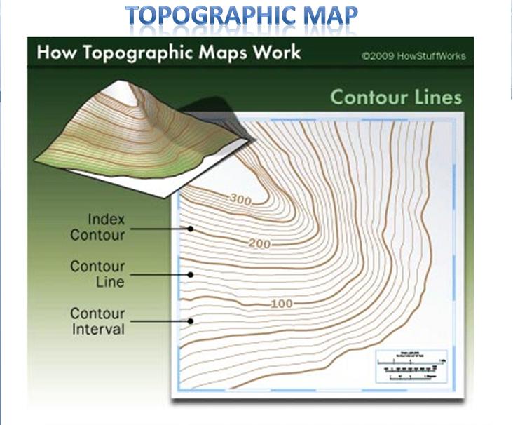
The illustration above demonstrations how a topographic map expresses elevation of a geographical area. Contour lines are used to map elevation areas with grading heights displayed on each line. Within the "intervals" more contour lines are drawn to show variance with the area. The methodology would also work on a 3-D image.
No comments:
Post a Comment